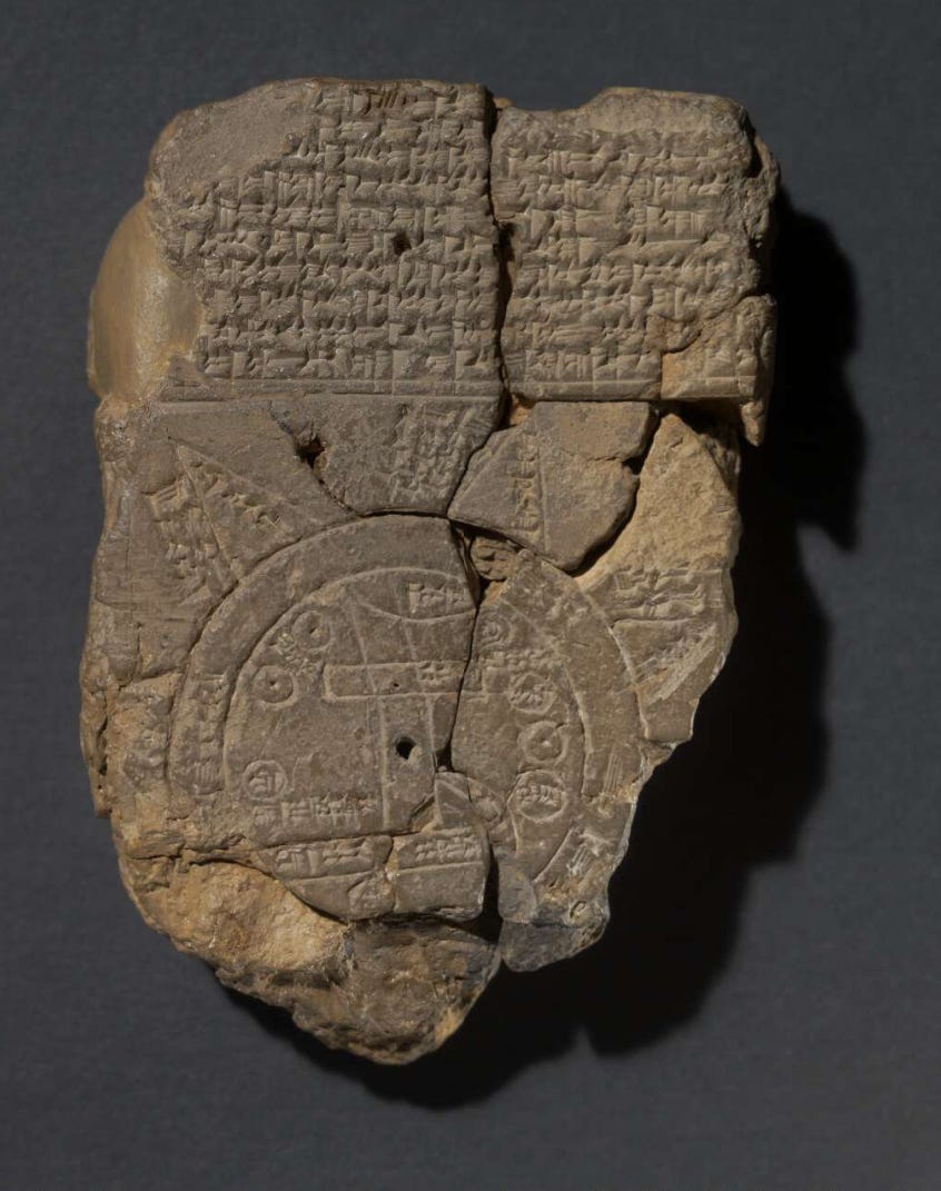
It is of course not a coincidence that the earliest maps track the development of human abstract thought. For when humans first learn to represent, the first thing they do is start drawing representations of the terrain they inhabit. They start making maps. Cartography may belong to geographers, explorers and scientists, but mapmaking belongs to us all.
Some of the earliest known maps date back to the Upper Paleolithic period, around 25,000–30,000 years ago. These maps were often simple carvings on bones, stones, or cave walls, depicting local geography, hunting territories, or routes. One notable example is a map from the Abauntz Cave in Spain, which dates back to around 12,000 BC.
But the earliest known geographical map dates back to the 6th century BC. The Babylonian World Map is an imago mundi, an image of the world, a representation of the known world with Babylon at its centre.
Most European and Asian mapmaking traditions had this in common: the maps were centred and they represented a worldview as well as the territory they covered. They represented a living and lived perspective.
The ancient Roman maps were centred around Rome, caput mundi, and conveyed the Republic or Imperial point of view, with the Roman roads leading out from the urbs like the spoke of a wheel. Western medieval maps or mappaemundi were centred around Jerusalem and represented the known world as a perfect circle, circumscribing Europe to the left, Asia to the top and Africa to the right. The maps were said to be oriented, from the word oriens meaning East, the rising, oriri, of the Sun, which meant that their orientation was oriental, to the East.
The orientation, whether to the East, or, counter-etymologically, to the North as in modern maps, is not just orientative - it is perspectival. Thomas Nagel made it clear : there is never a view from nowhere. The north-up orientation of modern Mercator map projections doesn’t provide a non-perspectival perspective, a view from anywhere and nowhere, as scientism often claims. Instead, it offers the perspective of the Northern hemisphere cultures who contributed to the modern science of cartography, the Greeks, Romans, Western medievals, Persians, Arabs, Chinese. A representation of Earth from space is equally perspectival, a view from a given point in space, even if the coordinates are never seen as relevant.
Stepping outside the map, rather than being the desirable non-perspective of objective representation, turns out to be a symptom of alienation. Outside the map, there is no terrain, and where the terrain is missing, so is everything that makes us human, and able to articulate anything meaningful.
You also make me think about the relative distortion of land mass areas, depending on where one thinks of as the centre of the world. (Speaking of Mercator.) Images drive thoughts and attitudes.